
From tropical wetlands and fields of wildflowers to barrier islands and yawning canyons, Texas boasts some of the most diverse (and gorgeous) ecosystems in the United States. The best way to see everything the Lone Star State has to offer? On foot. Here are the top hikes through Big Bend National Park, Hill Country and beyond.
Videos by Outdoors
Gorman Falls Trail
Where: San Saba and Lampasas Counties, Texas
Length: 2.8 miles out-and-back
Time: 1.5 hours
Difficulty: Easy
What to expect: This short, rocky hike might not seem like much at first, but packs a big payoff: a 70-foot, spring-fed waterfall. You’ll feel transported out of Texas while traversing the lush, verdant forest.
Pets permitted: Dogs are welcome, but must be on a leash.
Muleshoe Bend Trail
Where: Burnet County, Texas
Length: 5.9 miles loop
Time: 2.5 hours
Difficulty: Easy
What to expect: Here’s one for wildflower aficionados. In the spring, head to Muleshoe Bend Recreation Area just west of Austin where you can hike through miles of blossoming bluebonnets. At their peak, the fields look like something out of The Wizard of Oz.
Pets permitted: Dogs are welcome, and may be off-leash in some areas.
Palmetto Interpretive Trail
Where: Gonzales County, Texas
Length: 0.3 mile out-and-back
Time: 30 minutes
Difficulty: Easy
What to expect: Featuring a swamp, tropical trees and its namesake dwarf palmettos, this interpretative trail reads more Deep South than Lone Star State. The thick greenery makes a great habitat for wild animals like deer and armadillos, and is part of the Texas Bird Watching Trails network.
Pets permitted: Dogs are welcome, but must be on a leash.
Lighthouse Trail
Where: Armstrong and Randall Counties, Texas
Length: 5.8 miles out-and-back
Time: 3 hours
Difficulty: Moderate
What to expect: Located in the second largest canyon in the United States, Palo Duro, this popular trail leads to a famous 300-foot rock pillar dubbed the Lighthouse. Along the way through the eroded cliffs, spot desert shrubs, cacti and the endangered Texas Horned Toad.
Pets permitted: Dogs are welcome, but must be on a leash.
Lost Maples East Trail

Where: Bandera County, Texas
Length: 5.2 miles loop
Time: 3 hours
Difficulty: Moderate
What to expect: Leaf peeping isn’t only for the Northeast. Hike through Lost Maples State Park in the fall to marvel at the brilliant colors of the Uvalde Bigtooth Maple trees, a swath of maple forest that survived changes in the climate after the Ice Age.
Pets permitted: Dogs are welcome, but must be on a leash.
Guadalupe Peak Trail
Length: 8.4 miles out-and-back
Where: Hudspeth and Culberson Counties, Texas
Time: 8 hours
Difficulty: Hard
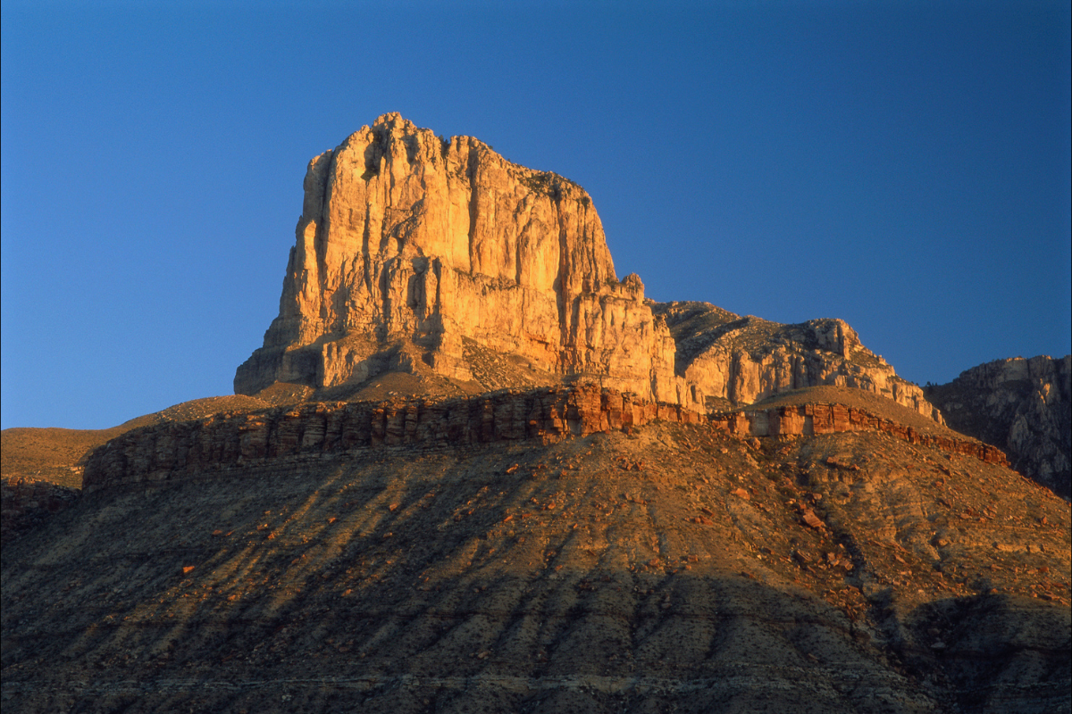
What to expect: To reach the highest point in Texas, hikers can climb a strenuous 3,000 feet to Guadalupe Peak in Guadalupe Mountains National Park. At the top enjoy jaw-dropping views of high-elevation forests, rugged desert, and the world’s most extensive Permian fossil reef. On a clear day you might even see the Davis Mountains 125 miles in the distance.
Pets permitted: Dogs are not allowed.
Mount ‘Ol Baldy Trail
Where: Uvalde County, Texas
Length: 1.1 miles out-and-back
Time: 1 hour
Difficulty: Moderate
What to expect: The most popular hike in Garner, Texas’ most-visited state park, this quick but challenging trail leads up its main landmark, Mount ‘Ol Baldy. From the summit, gaze down the Frio River and say hello to the local mountain goats.
Pets permitted: Dogs are not allowed.
Lone Star Hiking Trail
Where: San Jacinto County, Texas
Length: 96 miles point-to-point
Time: Varies
Difficulty: Varies
What to expect: At nearly 100 miles long point-to-point (plus an additional 32 miles of loop and crossover trails) the Lone Star Hiking Trail ranks as the longest trail in Texas. Most people treat it as a multi-day hike and only follow along for a section, soaking up the silence of the thick pine woods and swamps of the Sam Houston National Forest.
Pets permitted: Dogs are welcome, but must be on a leash.
Enchanted Rock Summit Trail
Where: Gillespie and Llano Counties, Texas
Length: 1.3 miles out-and-back
Time: 1.5 hours
Difficulty: Moderate
What to expect: The only way to describe the hike to the summit of Enchanted Rock: magical. The second-largest monolith in the United States, the rock itself covers 640 acres, and got its name from early Spanish explorers who thought it was supernatural due to the way it glowed at sunset. At the top, check out the vernal pools (pits that hold water for several weeks) and the translucent freshwater shrimp that live in them.
Pets permitted: Dogs are not allowed.
Sculpture Falls Hike
Where: Travis County, Texas
Length: 3 miles out-and-back
Time: 1.5 hours
Difficulty: Easy
What to expect: One of Austin’s most popular trails, Barton Creek Greenbelt’s Sculpture Falls Hike offers a secluded swimming hole at the end where locals like to shake off the summer heat. Pick your wading pool, bring a picnic, and spend the afternoon doing absolutely nothing.
Pets permitted: Dogs are welcome, but must be on a leash.
Haynes Rides and Upper North Prong Trail
Where: Briscoe County, Texas
Length: 6.3 miles loop
Time: 5.5 hours
Difficulty: Hard
What to expect: Soak up the wild beauty of Caprock Canyons State Park on this rugged and remote trail that features a scenic overlook at Haynes Ridge. You’ll pass hoodoos, spires, buttes and other fascinating rock formations, as well as Fern Cave, a fern-lined grotto.
Pets permitted: Dogs are welcome, but must be on a leash.
Lost Mine Trail
Where: Brewster County, Texas
Length: 4.8 miles out-and-back
Time: 2.5 hours
Difficulty: Moderate
What to expect: A favorite of many Big Bend National Park visitors, Lost Mine Trail is named after a rumor that a secret mine existed in the area. Legends aside, the hike affords some of the best views of Casa Grande Peak and the surrounding desert in the park.
Pets permitted: Dogs are not allowed.
Fate Bell Shelter Pictograph Walking Tour
Where: Val Verde County, Texas
Length: 1.5 miles out-and-back
Time: 1.5 hours
Difficulty: Easy
What to expect: Although you can only go on a guided hiking tour of the Fate Bell Shelter, it’s more than worth it to witness the rare rock paintings left by prehistoric peoples over 7,000 years ago. Some of the oldest Native American pictographs in North America, the art is protected from the elements by a huge rock overhang.
Pets permitted: Dogs are not allowed.
Santa Elena Canyon Trail
Where: Brewster County, Texas
Length: 1.7 miles out-and-back
Time: 1 hour
Difficulty: Easy
What to expect: To experience one of Big Bend National Park’s most iconic sites up-close, hike through Santa Elena Canyon, one of the three major canyons along the Rio Grande. As you wind through the canyon, be sure to gaze up at its 1,500-foot limestone walls and feel smaller than you ever have in your life.
Pets permitted: Dogs are not allowed.


“Near Austin”. South Rim trail is 473 miles away – an 8-hour drive.
Seriously?