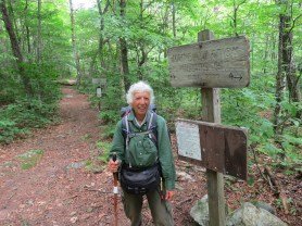

Pinch-In Trail is an idyllic hike located in the beautiful Linville-Gorge area of North Carolina. However, it’s garnered attention for a sinister reason. Recently, first responders had to rescue a hiker after they ventured down the rough and rugged trail in an attempt to see fields of flowers at Daffodil Flats.
Over the years, the popular hiking trail has been responsible for dozens of rescues since hikers flock to the area to get a glimpse of the blooming daffodils. Despite simply wanting to see the picturesque scene, McDowell County officials had to rescue someone “in distress” after attempting the hike.
According to a Facebook post from Burke County Rescue on Feb. 25, first responders received a call from someone saying someone in their group had gone into cardiac arrest.
Nearly 40 first responders arrived and later took the hiker to EMS officials for medical attention. Before the rescue, the hiking group worked together to get the hiker to safety.
Unfortunately, the trails in the area have minimal signage, warning hikers of the treacherous terrain. As a result, more rescues have occurred in the area.
Why You Should Think Twice Before Attempting This Hike
Linville Gorge is located in North Carolina’s Blue Ridge Mountains. Every year in late February and early March, sprawling fields of daffodils bloom, beckoning hikers from all over the area to catch a peek.
However, if you want to soak up this view, it will cost you some sweat equity. Linville Gorge is one of the southeast’s most strenuous, rough, remote hiking areas. Since it’s classified as a federal wilderness area, the trails aren’t marked properly and well-maintained.
During the trek, hikers must descend about 2,500 feet, heading in and hiking up that distance in under two miles while going out. According to experts, the quickest, easiest way to Daffodil Flats is a five-mile round trip. However, people report it feels like double that once they’re done.
In addition, the dire need for trail markers and signage is another reason to think before you attempt this trail. Hikers have reported trees down on the trails, erosion, and some sections that require people to use their hands and knees. Moreover, finding any maps of the Gorge is relatively impossible, meaning your navigation skills will be tested to the max.
If this hike isn’t for you, check out other North Carolina hike that are just as stunning.


Wilderness Areas in the United States are without signage on purpose. It is a Wilderness. To say they are not marked “properly” is a misuse of the description. They are not marked intentionally. There’s really nothing “sinister” about it. Most trail mapping soft wear works in the Linville Gorge. There are other online resources as well. A on-line search will locate them. This hike is tough and people do get rescued. However, the entire Linville Gorge is tough and rescues happen throughout the year on virtually every trail.