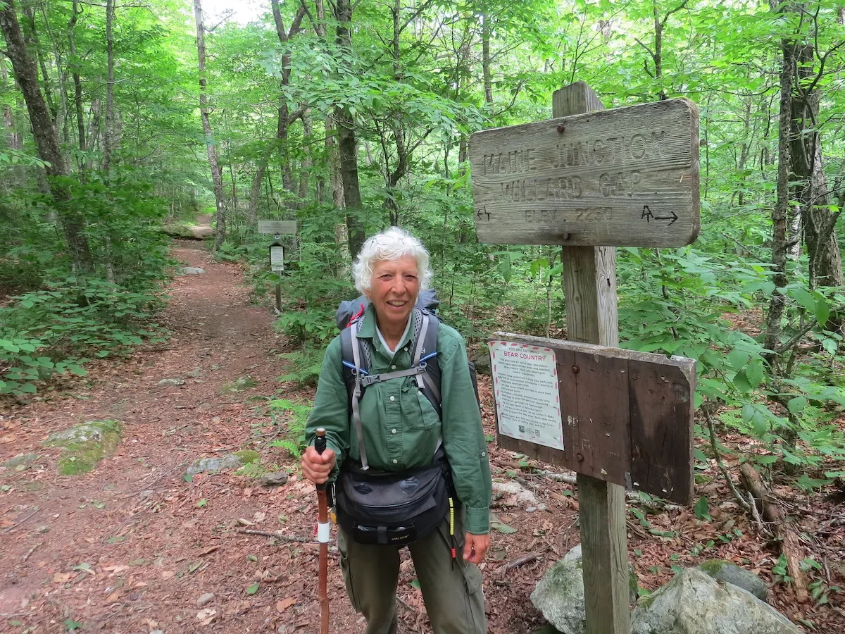

Joan Young is a 75-year-old Michigan resident who has hiked the 4,800-mile North Country National Scenic Trail (NCT)—twice. The NCT runs through eight U.S. states, from North Dakota to Vermont. She wrote two books about her first journey, North Country Cache and North Country Quest. Here, she shares a firsthand account of her second trek, which she completed just last month.
I am in love with the North Country National Scenic Trail. The NCT is one of 11 National Scenic Trails, authorized by Congress to showcase “nationally significant scenic, historic, natural, or cultural qualities” along their corridors. Almost everyone who loves the outdoors in America is familiar with the Appalachian, the Pacific Crest, and Continental Divide National Scenic Trails. Each of these trails runs north-south and is approximately 2,000 miles long. However, the NCT is an east-west trail that wanders through the landscape of eight northern U.S. states for over 4,800 miles. Along that tortuous route, the trail abounds in riches worthy of a National Scenic Trail.

NCT, Round 1: 1991-2010
Thanks to a large roadside sign, I discovered the NCT in 1988 and first followed the blue blazes that mark its treadway in 1991. It wasn’t until 1995, after sampling 281 miles of the trail in four states, that I realized I wanted to hike the whole thing. But I wasn’t in any particular hurry.
For one thing, I had to work between my hiking opportunities. Every summer, though, my best friend and I—often accompanied by one or two other friends—would hike approximately 100 miles of the trail. We loved it for more than just the hiking. We would immerse ourselves in the local culture and history. This included everything from team penning of cattle in North Dakota (a taste of the American West) to lumbering reenactments, to sampling small-town museums, to the Crown Point Fort in New York, considered to be the best-preserved Revolutionary War-era fort in the United States—and the list goes on and on.
Soon, I began adding shorter hikes in the spring and fall, but the trail kept growing. From the original estimate of 3,200 miles, by 1995 it was about 4,400 miles long. I completed New York to North Dakota in 2010 and added the then-unofficial Vermont miles in 2014 for a total of 4,455 miles.
As soon as I completed all the chunks of this hike, I knew I wanted to do it again. By the time I finished, so many miles had changed or been taken off road since I hiked them. Even though I’d done it once, it seemed too formidable to dedicate the time and avoid deep winter. (It’s not called the North Country Trail for nothing.)

NCT, Round 2: 2021-2023
In the middle of the night sometime in 2019, I woke up with the answer to this dilemma. I realized that if I started near my home in the middle of Michigan’s Lower Peninsula and hiked south (trail east) in December, I could hike through Ohio in the winter, reaching Pennsylvania and turning north/east just in time for spring to begin melting any deep snow.
I calculated that if I averaged 15 miles a day, with some days off, I could complete the hike in a year. This would get me through the Upper Peninsula before the serious winter snow set in. Fast forward through 2020 and most of 2021. I finished refurbishing a little fiberglass trailer to be my support vehicle. My concession to my age was that I would not try to backpack the entire trail. Friends signed on to travel with me and fix meals, spot me at the trail from day to day and generally keep me on track. I did plan to backpack portions where road access was difficult, but as much as I love being outdoors, I wanted to succeed and doubted I could backpack that many days in a row, walking 15 miles a day.
I’m in good condition for my age (75 at time of completion of the hike in June 2023), but I had no idea if I could really walk that far day after day for a year. Also, because of my familiarity with this trail, I knew there were sections of serious physical and mental challenge.
Despite any trepidations, on December 1, 2021, I hiked away from Timber Creek on US 10, heading for Vermont. For some reason that escapes common sense, I decided to backpack the beginning in winter. Perhaps I was thinking it would give my effort some credibility. My energy and spirits were high, and in five days I was south of the Manistee National Forest and facing the longest stretch of road-walks on the trail. This allowed me to make good time, and I spent Christmas with a friend whose house is just across the road from the trail in northern Ohio.
Ohio boasts almost 1,100 miles of trail, with about 900 being concurrent with the Buckeye Trail that encircles the state. Ohio’s focus is on history. Canal and railroad routes define huge sections of the trail, punctuated by two crossings of the 1811 National Road (Cumberland Road). Many communities along the old transportation routes are embracing their history and restoring or recreating infrastructure. Southern and eastern Ohio offer plenty of topography in the foothills of the Appalachians. Long-distance hiker “Denali” (her trail name) joined me for approximately 540 miles along the most southern portion of the state and the entire trail.
Pennsylvania is short with 285 miles of trail, but these miles are almost entirely off road. Highlights include walking through two long former-railroad tunnels and the rocks and hills of the Allegheny National Forest.
Nothing in the next leg, New York, is flat except for a few miles along the historic Erie Canal. Before reaching that piece near Rome and Fort Stanwix of colonial era importance, the forested hills of the Southern Tier and the Finger Lakes, shared with the Finger Lakes Trail, must be crossed. For total elevation change per day, western New York is the toughest portion of the entire trail. Beyond Rome, the trail heads north and enters the Adirondack Park. Although the trail was not allowed passage through the High Peaks, a beautiful, rocky southern route through the park has, after many years, been negotiated and can be hiked. I backpacked the two weeks it took me to traverse the Adirondacks.
After 690 miles, I entered Vermont, the newest and shortest of the NCT states. Although the original proposal included Vermont, for various reasons, this was not approved until 2019. The NCT now joins the Appalachian Trail at a place called Maine Junction on the Long Trail in the Green Mountains. Interestingly, the NCT goes from its lowest elevation at Lake Champlain (100 feet above sea level) to Gillespie Peak (3,366 feet) in about 50 trail miles.

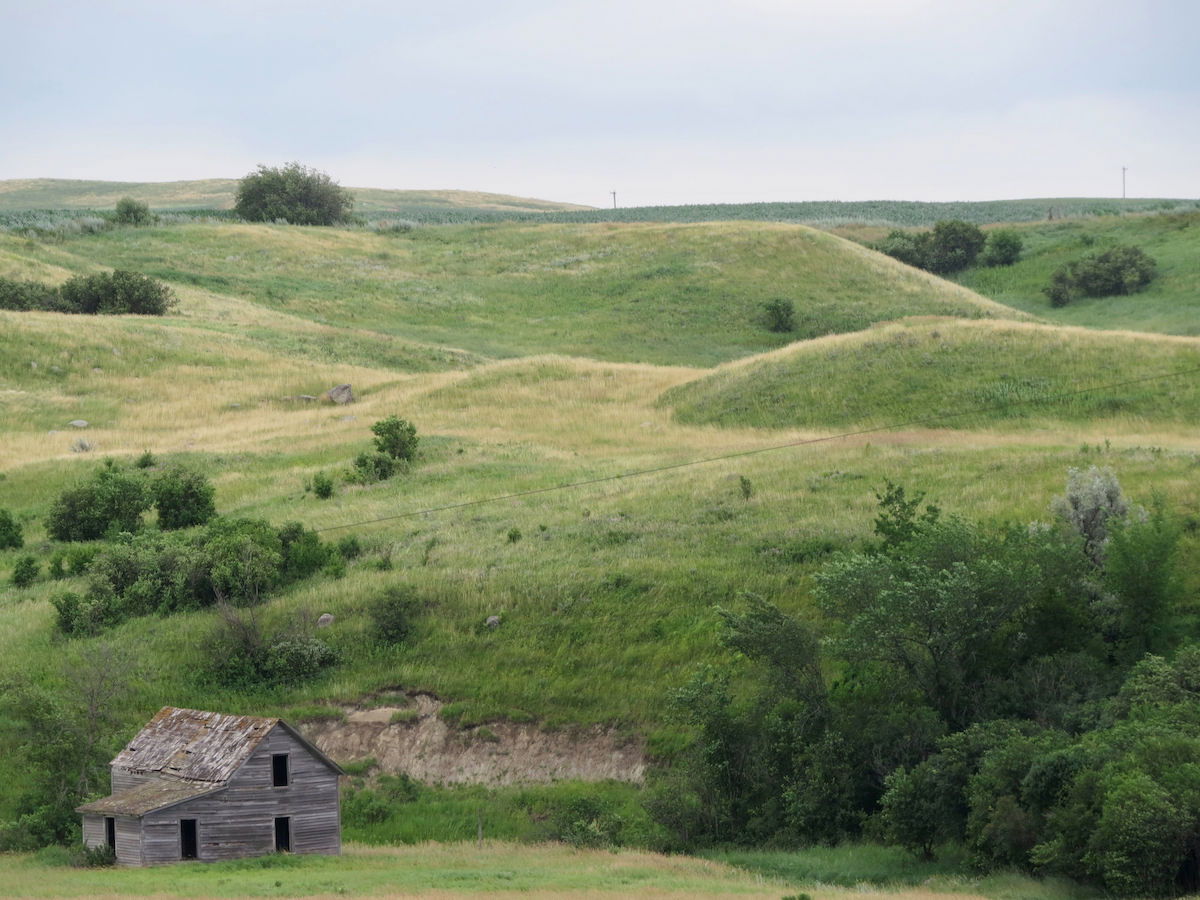
Fast forward with a week of travel, and I walked east from Lake Sakakawea in North Dakota on June 25, 2022, a little behind my proposed schedule, but not alarmingly so. However, the heat soon became a factor. Some days it was over 100° Fahrenheit, and the only way I could keep going was to pour water from the irrigation canals over my head. However, North Dakota shares a different kind of beauty. This is tall grassland and the prairie pothole region. Waterfowl abound, and the botanical palette is different from the rest of the trail. Big sky above for 465 miles.
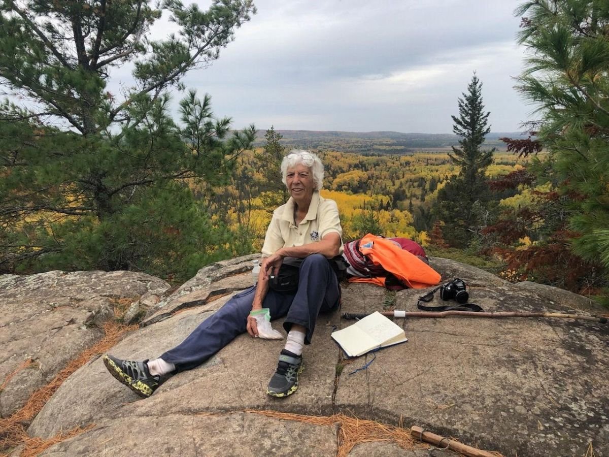
Minnesota transitions from prairie to hills. Turning north toward the Canadian border, trail in the Arrowhead showcases its volcanic origin as the route follows the Kekekabic, Border Route and Superior Hiking Trails. I backpacked about 104 miles where road access is impossible. Minnesota seemed incredibly long but has the third most miles—855. I chewed up a lot of time in logistics for the backpacking portions. I knew my ability to complete the hike in one continuous walk would totally depend on the onset of winter in Michigan.
Wisconsin was a fast 214 miles with a lot of new trail since I’d last hiked it. Beautiful miles of hilly and rocky terrain with waterfalls have been added to the route.
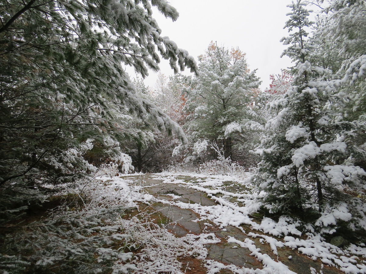
I entered the Upper Peninsula on November 6, 2022 and was now in a race with the weather. Easily making it past Lake of the Clouds, the next day the snow began, immediately closing the park roads to vehicles. My helper and I fled east only to be buried under 22 inches of snow at Ishpeming. Determined to keep hiking, we searched out places to access the trail, and I walked shorter distances. A heavy, wet snow in October had brought down many trees that were not yet cleared, and with the new snow, hiking was challenging at best and impossible in other places.
My goal of hiking contiguous segments had to be abandoned. We searched for any piece that could be accessed and walked. One day, I could only go three miles, because I knew I couldn’t reach the next access point before dark. Ultimately, though, I was able to walk every piece of the trail, except for the Trap Hills, where it just kept snowing.
From time to time along the way, various friends hiked with me. It was at this point in the trek that Bill Courtois of Ann Arbor, Michigan rejoined me. We encouraged each other, and hiking with someone through snow and ice added to our safety. We even found a way to day-hike through Pictured Rocks, which was spectacular in winter. David Snoek, of Hudsonville, Michigan and I contemplated winter backpacking through the snow-covered Trap Hills. Ultimately, we decided this would be foolish. Those miles are the hilliest in all of Michigan, and my gear would need to be upgraded for me to backpack in the dead of winter.
On November 30, 2022, not only was I certain I couldn’t come close to my original goal of completing the hike in a year, but I also knew the miles in the western Upper Peninsula that I’d skipped would have to be abandoned until at least May of 2023, and possibly even June. This was the most discouraging day, as I realized I could not fulfill my desire to complete a continuous hike.
Bill and I hiked on through the eastern Upper Peninsula for as long as we could, staying just ahead of the deep snow. How many people can say they had Tahquamenon Falls all to themselves?
Just 40 miles north of the Mackinac Bridge, I decided to go home for a seasonal break. The snow was piling up, and I was only able to make about six miles a day on snowshoes. This seemed impossibly slow, and I decided it was better to get some needed rest, since I was not going to be able to complete the trail until spring came to the western Upper Peninsula.
Indeed, I was more tired than I realized, but my body healed. In March 2023, Bill and I returned to finish the remaining miles north of the bridge and to do the northern Lower Peninsula. Once again, the snow had something to say about that plan. It was beginning to rot, and postholing through foot-deep slush was dispiriting. At least, with Bill in agreement, I knew I wasn’t just being a wimp. Once again, I had to make progress by searching out any piece of trail that was walkable. Finally, the snow disappeared, and we completed everything except the Trap Hills (those 100-plus miles that derailed the whole timeline) and a short segment north of Timber Creek.
The Trap Hills had been covered by 40 inches of snow for months, and in May, record temperatures melted it all in one week, washing out roads and culverts. Every county we needed to hike became eligible for disaster status. Finally, in early June, Bill, David, and I returned to the Upper Peninsula and easily hiked over those rocky, copper-infused bluffs.
Then on June 18, 2023, a good-sized group of friends joined me for those final six miles into Timber Creek, closing the Michigan connection of 1,170 miles. We celebrated the completion of all 4,815 miles of North Country Trail.
‘In Walking Is the Solution’
Although I was not able to do the hike quite the way I had planned in one year, the final figures worked out to a total elapsed time of 18 months and 18 days. Actual hiking days, though, came to exactly 365, which was quite a pleasant surprise. My daily average for hiking days only was 13.2 miles. Although these are not quite the statistics I had hoped to report, they are satisfactory.
My motto has always been, “hiking solves everything.” It turns out that Augustine said it long before I did: Solvitur ambulando or “in walking is the solution.” I still believe it’s true, although for the next little while, I think I’ll be happily playing in my flower gardens rather than hitting the trail every morning.
The North Country Trail presents a mental challenge as well as a physical one. It’s much more than the “walk in the park” some people assume it to be. It offers beauty, ruggedness, serenity, history, and culture. It traverses mountains, glacially carved terrain, outwash plains, volcanic rocks, eroded plateaus, four continental watersheds, and crosses two continental escarpments. It touches three of the five Great Lakes. It passes through two major cities and hundreds of small towns.
Sampling shorter pieces of the trail at a time may be the most sensible approach to the NCT. This allows time to enjoy the treasures that are to be found along the way. However, both methods have their benefits. I found that my second journey on the NCT was a wonderful combination of familiar and loved sections and new places to savor and explore.



Your NCT journey was quite remarkable, and inspires me to set goals and get started working on them. Thank-you, and enjoy the rest of the summer!