
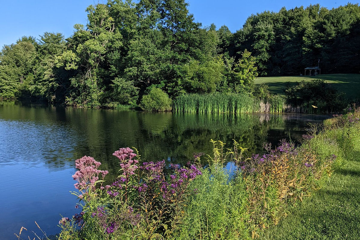
What makes a hike top-notch can differ depending on the hiker. For one person, an epic hike is reaching the top of a summit for unparalleled views. For another, it may mean multiple days of hiking while testing one’s limits. No matter the end goal, the United States is filled with wonderful hikes from coast to coast. Here are 18 hikes across the U.S. that offer everything from adrenaline pumping terrain to views of multiple states.
Videos by Outdoors
Ankle Express Trail – Oklahoma
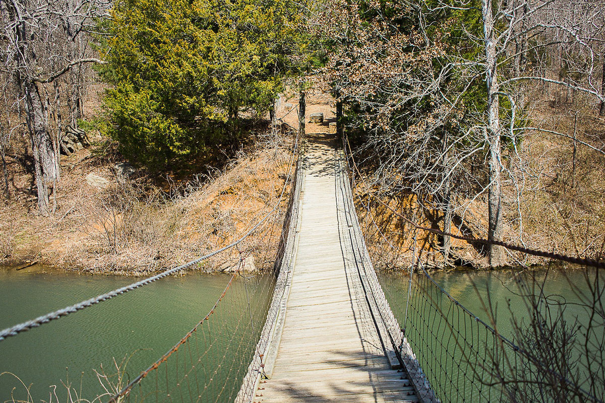
This out-and-back trail in Oklahoma is a must-do for locals and those visiting the state because of the suspension bridge over Greenleaf Lake. As a test of bravery, the bridge swings and sways as the trail crosses to the other side. It also winds through the forest and along the lake for added scenery. Leashed dogs can also test their balance to make it across.
- Distance: 5.3 miles out and back, 8 miles from campground
- Location: Greenleaf State Park, OK
- Difficulty: Easy
- Elevation Gain: 400 feet
Bean and Bear Lake Loop – Minnesota
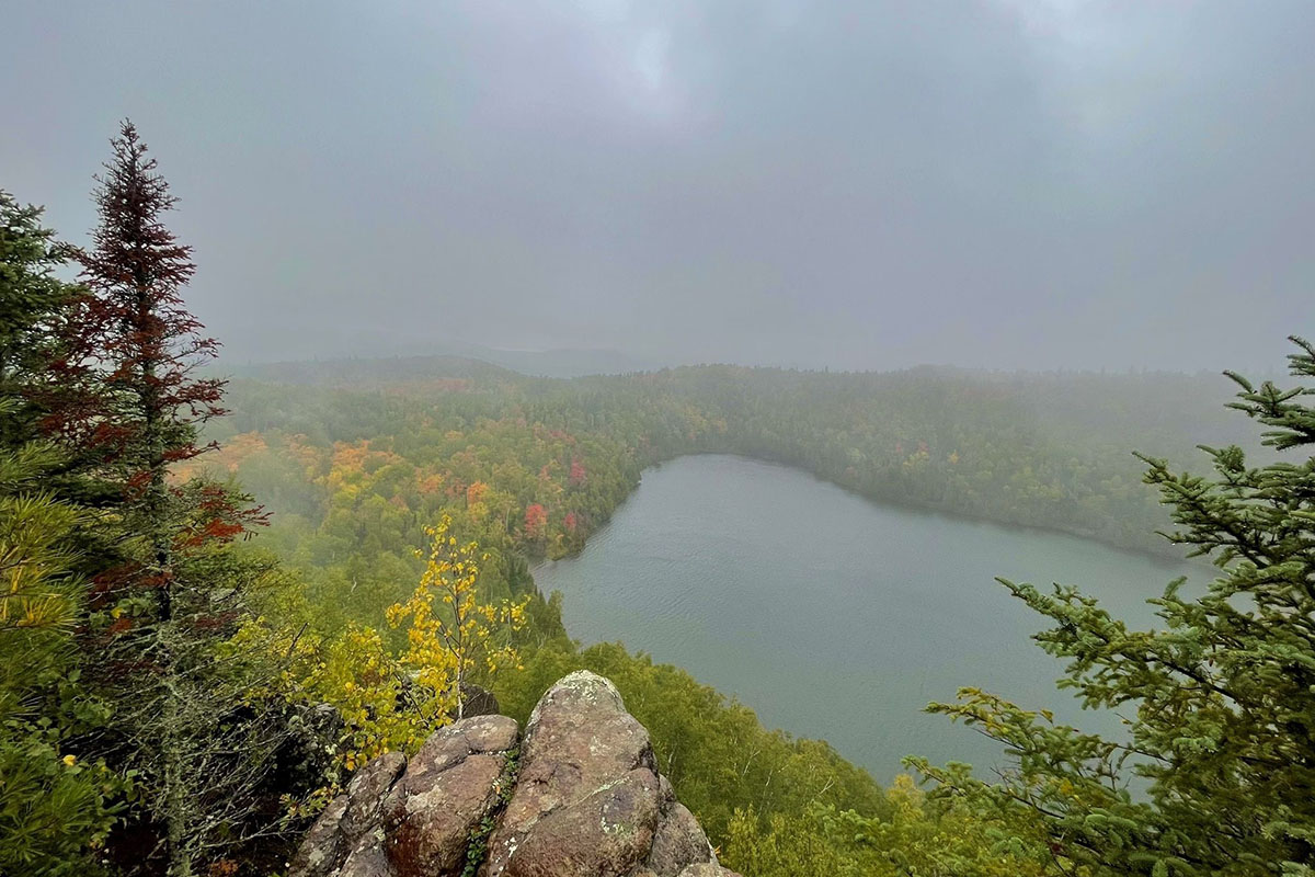
Climbing the first two miles of the hike may seem daunting, but the overlook views, wildflowers, and eagles that soar above the two lakes bring many hikers to this trail. This route is also popular for snowshoeing in the winter for a different view. Your pup can join you on this loop if he is leashed.
- Distance: 6.9-mile loop
- Location: Superior National Forest, MN
- Difficulty: Moderate
- Elevation Gain: 1,200 feet
Black Elk Peak Trail – South Dakota
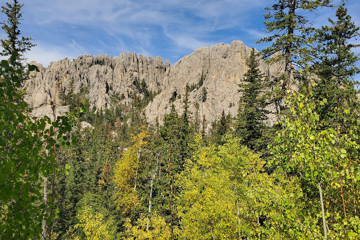
Hike up to the highest elevation between the Rocky Mountains in the western United States and the Pyrenees Mountains in France by summiting Black Elk Peak. The best route is to take trail #9 up for a gradual elevation increase and trail #4 down. On clear days, you can see into four states from the view at the top. Bring your leashed best friend on this hike too.
- Distance: 7 miles roundtrip loop
- Location: Custer State Park, SD
- Difficulty: Moderate
- Elevation Gain: 1,500 feet
Buckeye Trail – Ohio
Crossing 1,444 miles from Lake Erie to the Ohio River and around the state, the Buckeye Trail gives a view of some of the most unique places in the state. The 40 miles within Cuyahoga Valley National Park are the most popular and difficult. Each of the 26 sections of the trail is named for a feature or town within the section.
- Distance: 1,444 miles
- Location: Ohio
- Difficulty: Easy to Difficult
- Elevation Gain: Approx 5,000-6,000 feet
Canyon to Rim Loop – Oregon
Children and adults can enjoy watching climbers head up several top-notch crags like the Phoenix Buttress along this easy hike. Hikers get a lot of bang for their buck in terms of views, from the Crooked River to the sheer rock walls. Wildlife viewing is also a highlight, and you can see everything from otters to eagles. Leashed dogs can enjoy the hike and some of their own rock scrambling, too.
- Distance: 3.4 miles roundtrip loop
- Location: Smith Rock State Park, Oregon
- Difficulty: Easy
- Elevation Gain: 452 feet
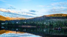
Grinnell Glacier – Montana
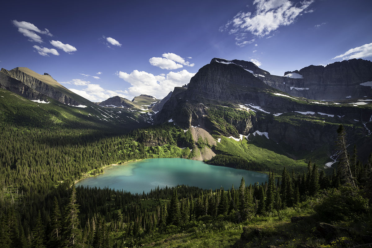
The hike to Grinnell Glacier in Glacier National Park is a must-do for the epic beauty and the chance to experience a glacier up close. Trail lovers walk through a waterfall, experience wildlife—from bears and bighorn sheep to moose and mountain goats—and take a cold plunge in a glacier-fed pool. A boat service can shorten the hike by 3.5 miles roundtrip and launches from the Many Glacier Hotel.
- Distance: 10 miles roundtrip out and back
- Location: Glacier National Park, MT
- Difficulty: Moderate
- Elevation Gain: 2,047 feet
Harding Icefield Trail – Alaska
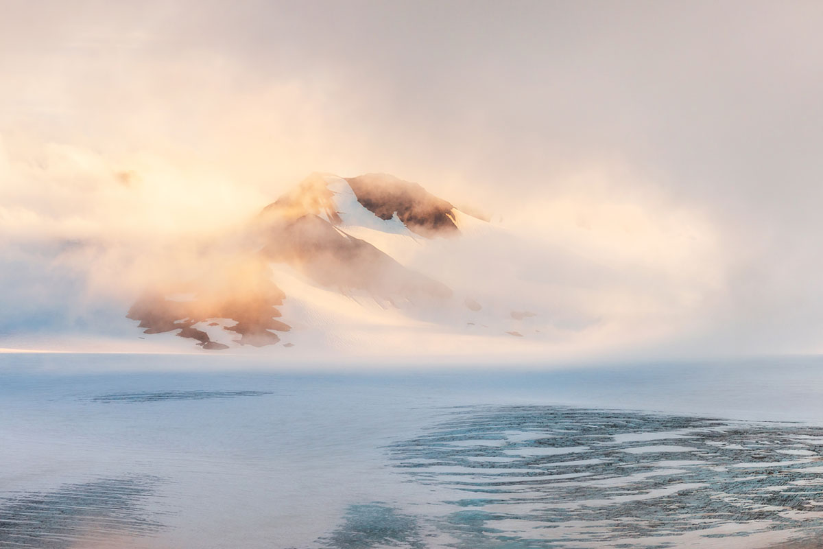
A strenuous hike beginning on the floor of the valley, the trail goes through the forest as it climbs up to an overview view of the icefield. May through October is the best time to hike, although snow often lasts through July on parts of the trail. It’s considered a technical mountaineering route from November through May, when specialized experience and equipment are needed.
- Distance: 8.2 miles roundtrip out and back
- Location: Kenai Fjords National Park, AK
- Difficulty: Difficult
- Elevation Gain: 3,200 feet
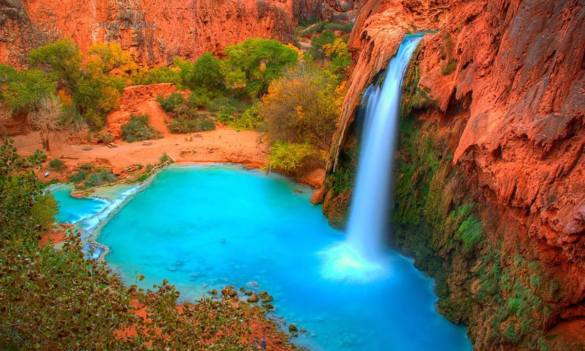
Havasu (Havasupai) Falls – Arizona
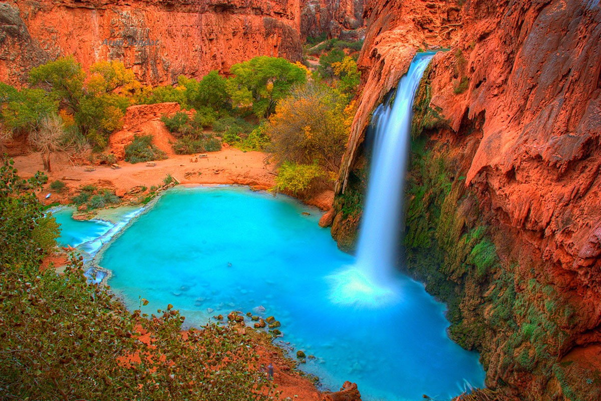
A bucket-list hike for many adventure seekers, the hike to Havasu Falls was closed for an extended period of time due to COVID. It’s open now, but don’t think you can just pack up and go on this trek. To hike this trail, you need to obtain a permit and work out the logistics for where you will rest your head (options include the campground or the lodge). This backpacking route takes you up close to five main waterfalls.
- Distance: 25 miles roundtrip (with trip to Beaver Falls)
- Location: Havasupai Indian Reservation/Grand Canyon
- Difficulty: Difficult
- Elevation Gain: 2,500 feet
Ice Lake – Colorado
A blue lake backdrop, wildflowers, and multiple peak views bring hikers to this epic trail during summer and fall. The hike begins below the treeline before it goes up through conifer and aspen forest to the basin. Your leashed four-legged friend can also enjoy the views.
- Distance: 7.5 miles roundtrip out and back
- Location: San Juan National Forest – Durango or Silverton, CO
- Difficulty: Difficult
- Elevation Gain: 2,400 feet
John Muir Trail – California
The John Muir Trail is many a thru-hiker’s dream trail, as it passes through several national parks on the west coast, from Yosemite to Sequoia. A crown jewel of thru-hikes with mountain peaks and fields of wildflowers, this permitted hike begins at Yosemite National Park and ends at the highest point in the contiguous U.S.—Mount Whitney.
- Distance: 211 miles one way
- Location: Yosemite National Park to Mt. Whitney
- Difficulty: Difficult
- Elevation Gain: 46,700 feet for full hike
Kalalau Trail – Hawaii
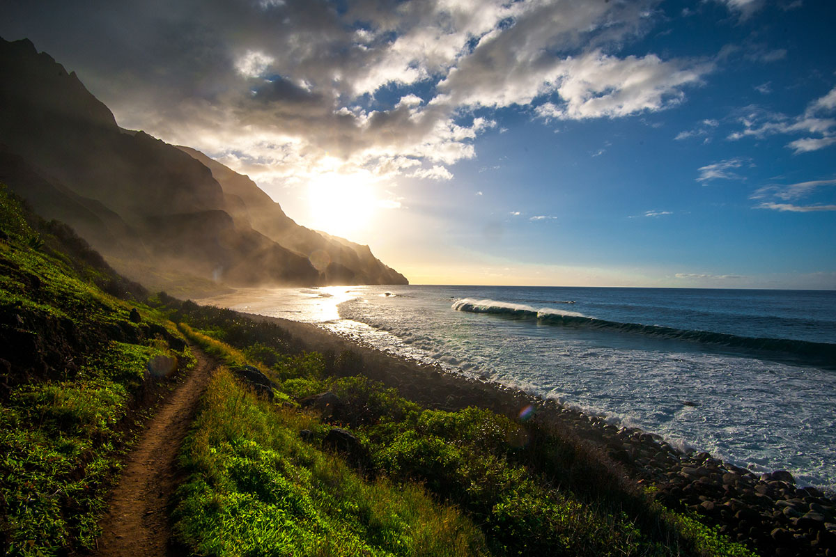
If you want to push your limits, the Kalalau Trail will do just that. On this hiking-pole-essential trail, hikers can expect steep drop offs and slippery, wet conditions as they traverse through five valleys. The trail serves as one of the few ways to access the Napali Coast from land. A day pass is required to hike the first few miles through to Hanakāpīʻai Valley. If you plan to hike beyond Hanakāpīʻai Valley, a camping permit is needed.
- Distance: 22 miles roundtrip out and back (4 roundtrip miles to Hanakāpīʻai Valley)
- Location: Kauai, HI
- Difficulty: Difficult
- Elevation Gain: 800 feet
Lower Calf Creek Falls – Utah
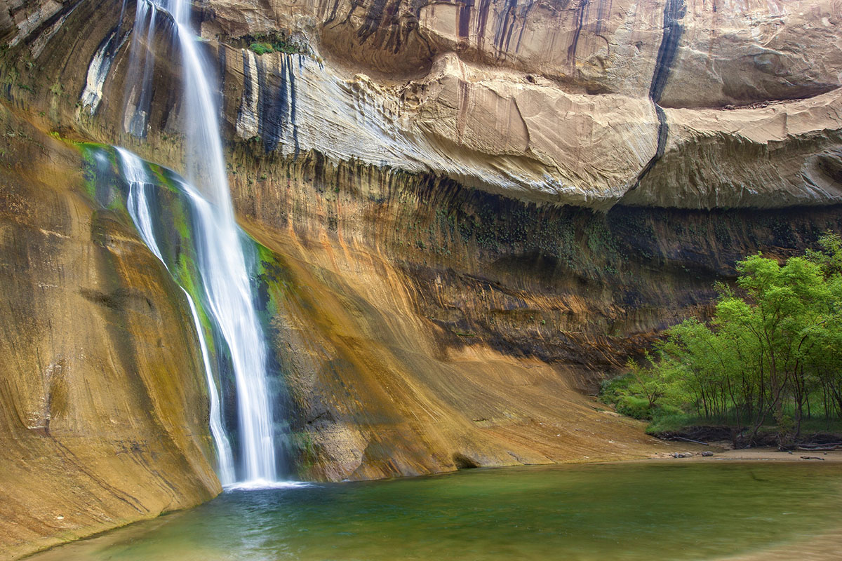
A mix of sand, slick rock, and dirt, the trail to Lower Calf Creek Falls is a hike that can be enjoyed by entire families. Be sure to pick up a brochure at the trailhead to point out various points along the trail—from a pictograph on the wall opposite the canyon to the location of a former watermelon farm. The falls drop 126 feet, forming a pool you can access year-round. For some solitude, consider hiking this trail in the winter. Leashed pups are allowed on this hike.
- Distance: 6.1 miles roundtrip out and back
- Location: Grand Staircase Escalante National Monument, UT
- Difficulty: Moderate
- Elevation Gain: 531 feet
Lighthouse Trail – Texas
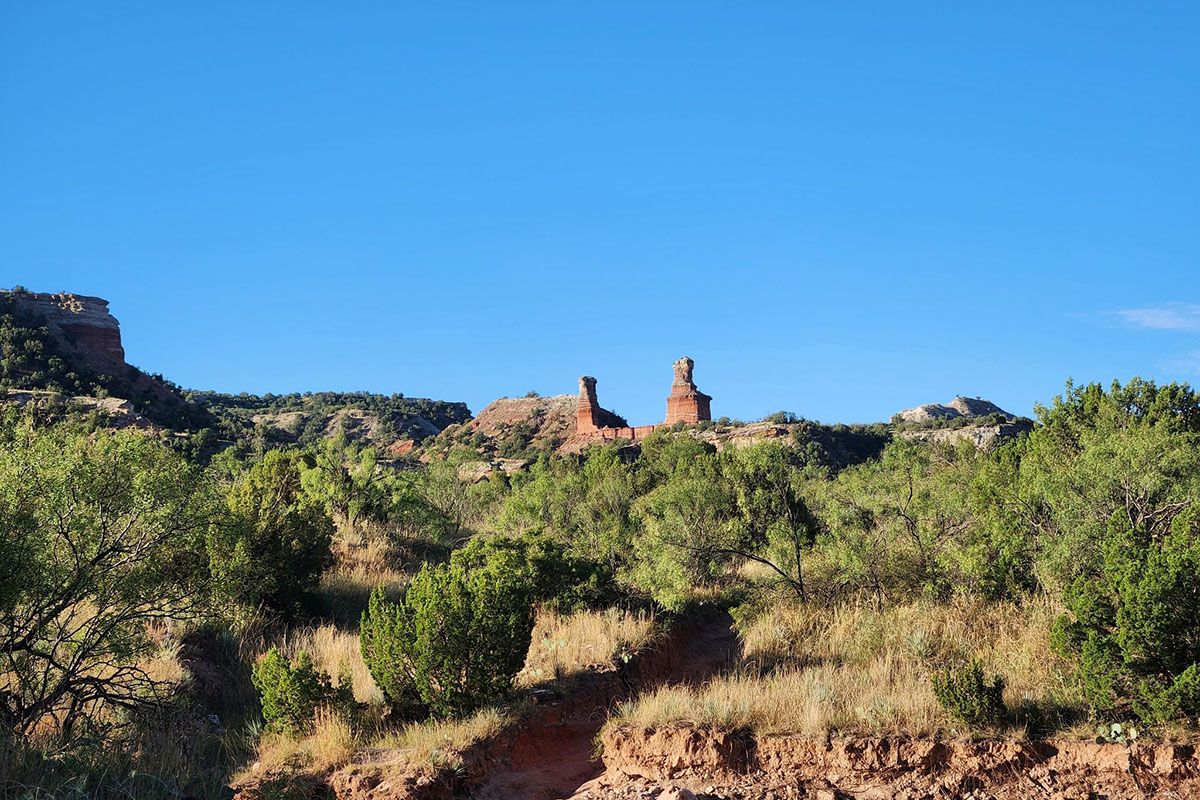
The second-largest canyon in the U.S., Palo Duro Canyon features a number of geological wonders, including the Lighthouse Hoodoo. The plains of the panhandle offer top hiking through rugged colorful terrain. Leashed dogs can also enjoy the canyon views.
- Distance: 5.8 miles roundtrip out and back
- Location: Palo Duro Canyon, TX
- Difficulty: Moderate
- Elevation Gain: 492 feet
Mount Mitchell – North Carolina

Conquering the tallest mountain in the eastern U.S. is no small feet. Mt. Mitchell measures 6,684 feet tall. Part of the Pisgah National Forest along the Blueridge Parkway, the changes along this trail make it popular. Besides the chance to see a variety of wildlife, the trail winds through the forest, past areas of springs and rock, and ends in an area of dense moss. Rover can join you on this hike.
- Distance: 11.4 miles out and back
- Location: Mt. Mitchell State Park, NC
- Difficulty: Difficult
- Elevation Gain: 3,689 feet
Petrified Forest Loop – North Dakota
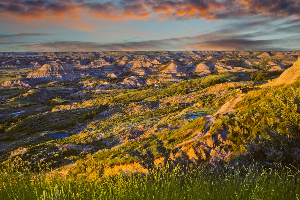
Featuring the third-largest highest concentration of petrified wood in the United States, the Petrified Forest Loop gives hikers a chance to see what the badlands area once looked like. Layers of rock, prairie lands, and wildlife help give this hike a colorful view into the past.
- Distance: 10.4 miles roundtrip loop
- Location: Theodore Roosevelt National Park, ND
- Difficulty: Easy/Moderate for length
- Elevation Gain: 833 feet
Precipice Trail – Maine
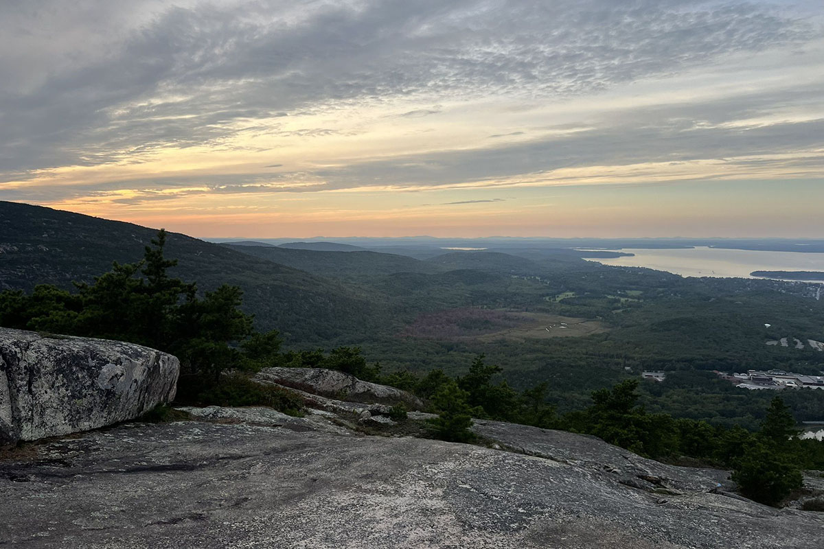
Sometimes referred to as the Angel’s Landing of the East Coast, the Precipice Trail is an adrenaline rush hike where the views and the large elevation gain in a short distance will take your breath away. Steep drop offs, ladders, and a between-the-boulders squeeze are all a part of this iconic hike. For some less heart-pumping fun, the Beehive Trail is an easier alternative with great views.
- Distance: 2.1 miles roundtrip loop
- Location: Acadia National Park, ME
- Difficulty: Difficult
- Elevation Gain: 1,050 feet
The Wave – Arizona/Utah Border
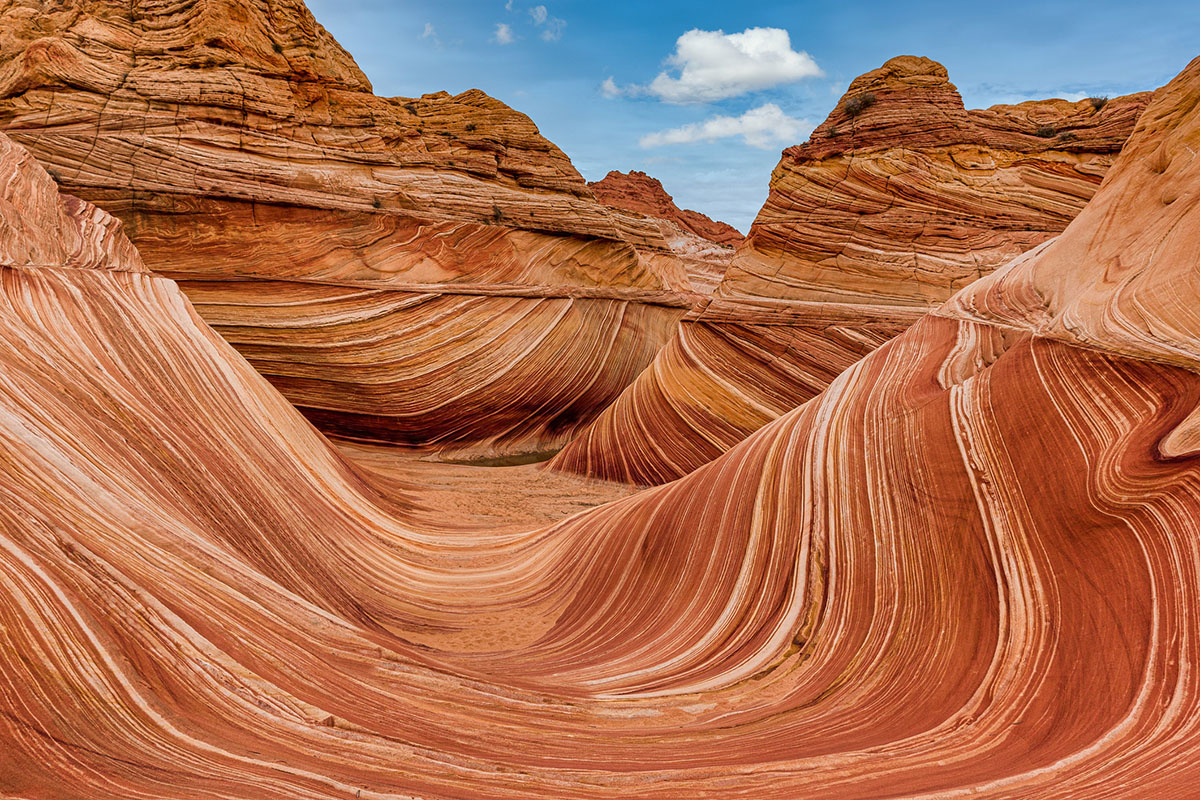
Hikers feel like they are on another planet when they experience the naturally carved colorful sandstone wave formations at Coyote Buttes in the Vermillion Cliffs National Monument. With no developed trail, trail seekers get to test out their navigational skills. A permit granted via a lottery system is needed for this hike.
- Distance: 6.7 miles out and back
- Location: Vermilion Cliffs National Monument, Arizona
- Difficulty: Moderate
- Elevation Gain: 1,204 feet
Walls of Jericho – Alabama and Tennessee
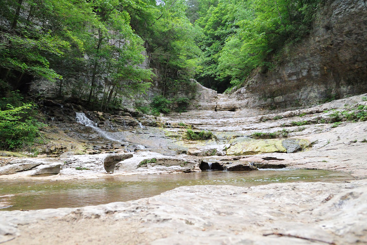
This trail has a bit of a reputation for being uphill both ways, and trekking poles are highly recommended for the uneven rocky terrain. Most choose to start on the Alabama side, but you can start on the Tennessee side for a longer hike. When the water is flowing, the Walls of Jericho create intrigue (where is the water coming from?), while limestone caves delight, and the Clark Cemetery from the late 1800s provides an interesting look into history. Leashed pups can enjoy the trail, but the roots and rocks may tear up their paws.
- Distance: 7.5 miles out and back (TN trailhead) / 6.6 miles out and back (AL trailhead)
- Location: James D. Martin Skyline Wildlife Management Area, Alabama
- Difficulty: Difficult
- Elevation Gain: 1,427 feet (TN) / 1,350 feet (AL)


Pingback: Best Top Hiking Trails USA: Epic Adventures Await