
In San Francisco, you never have to wander far to find a good trail. Rolling hills, temperate weather and lush greenery make this major city a true hiker’s paradise—and the dramatic bay views don’t hurt, either. Whether you’re looking for a quick trek within city limits or want to make the journey into a neighboring redwood grove or beach, here are the local San Fran hikes you shouldn’t miss.
Videos by Outdoors
Cataract Falls Trail
Where: Marin County, California
Length: 2.8 miles out-and-back
Time: 2 hours
Difficulty: Moderate
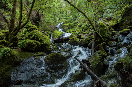
What to Expect: Push past the first mile of this uphill trek through a forest of bigleaf maple, redwood, and Douglas fir trees and you’re in for a treat. True to its name, you’ll discover cascading waterfalls throughout the hike.
Pets Permitted: Dogs are welcome, but must be on a leash.
Mount Davidson
Where: San Francisco County, California
Length: 1 mile loop
Time: 30 minutes
Difficulty: Easy
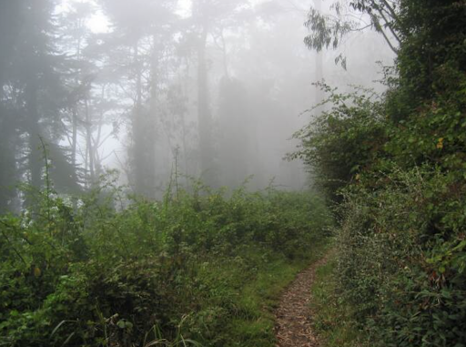
What to Expect: For a hike you can take BART to, head to Mount Davidson, the highest natural point in San Francisco at 938 feet. On the way to the top, where you’ll find the historic Mount Davidson Cross and the city’s signature fog, enjoy a woodsy selection of blackberries, pines, ivy, and eucalyptus.
Pets Permitted: Dogs are welcome, but must be on a leash.
Tennessee Valley Trail
Where: Marin County, California
Length: 3.4 miles out-and-back
Time: 1.5 hours
Difficulty: Easy
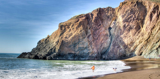
What to Expect: For an easy Bay Area hike, head across the Golden Gate Bridge to Tennessee Cove and follow the path along black sand beaches, rocks, and dense thickets. Watch for pelicans, ducks, and egrets in the lagoon and take a detour to Pirate’s Cove where you can dip your feet in the water.
Pets Permitted: No dogs allowed.
Mission Peak Loop
Where: Alameda County, California
Length: 5.8 miles loop
Time: 4 hours
Difficulty: Hard
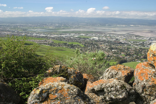
What to Expect: A steep, strenuous and continuous uphill climb, hikers love this challenging trail for its 360-degree views. On a clear day, you can even see the skylines of Oakland, San Francisco and San Jose from the 2,517-foot summit.
Pets Permitted: Dogs are welcome.
Batteries to Bluffs Trail
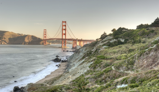
Where: San Francisco County, California
Length: 2.3 miles loop
Time: 1.5 hours
Difficulty: Easy
What to Expect: Just a fraction of the 24 miles of hiking trails in San Francisco’s Presidio park, this hike begins at Baker’s Beach (one of the most iconic beaches in the city). Snap a few pictures of Golden Gate Bridge and make your way along the serpentine blufftops.
Pets Permitted: Dogs not allowed.
Half Moon Bay Coastal Trail
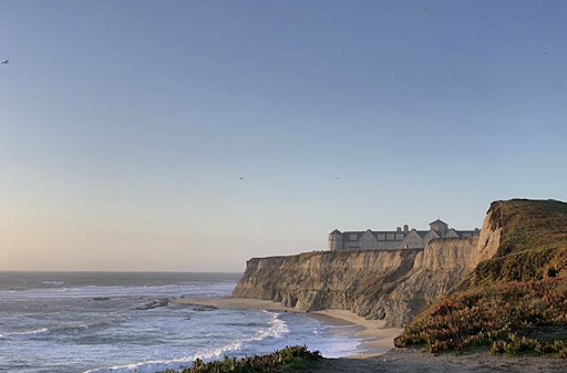
Where: San Mateo County, California
Length: 3.7 miles out-and-back
Time: 1.5 hours
Difficulty: Easy
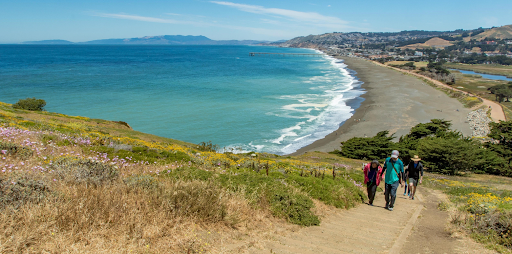
What to Expect: Running from El Granada and Pillar Point to Half Moon Bay and Poplar Beach, this chill multi-purpose trail winds along the coast, connecting several local beaches. Pause for a picnic on the sand or swim in the brisk Pacific waters.
Pets Permitted: Dogs are welcome, but must be on a leash.
Devil’s Slide Trail
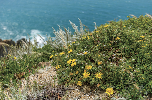
Where: San Mateo County, California
Length: 2.8 miles out-and-back
Time: 1 hour
Difficulty: Easy
What to Expect: Looking for idyllic ocean views without breaking a sweat? This is the hike for you. All you have to do is stroll along the coast and breathe in the salty air.
Pets Permitted: Dogs are welcome, but must be on a leash.
Matt Davis and Steep Ravine Trail Loop
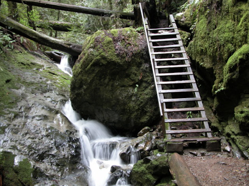
Where: Marin County, California
Length: 6.6 miles loop
Time: 4 hours
Difficulty: Hard
What to Expect: Starting north of the Golden Gate Recreation Area in Mount Tamalpais State Park, this ambitious hike covers three of the most popular Marin trails in one. Prepare to cover a lot of ground and check many of California’s natural wonders off your bucket list, including redwoods, waterfalls, dense forests, and Pacific Ocean views.
Pets Permitted: Dogs not allowed.
Mori Point Loop Trail

Where: San Mateo County, California
Length: 2.5 miles loop
Time: 1.5 hours
Difficulty: Moderate
What to Expect: Part of the Golden Gate National Parks Conservancy, Mori Point is a 32-acre wetland park with a trail that leads up to its coastal bluffs. In the spring, enjoy the company of birds and wildflowers, and keep an eye out for migrating whales in winter; the trail is the perfect vantage point to watch them breaching.
Pets Permitted: Dogs are welcome, but must be on a leash.
North Ridge and Sunset Trail Loop
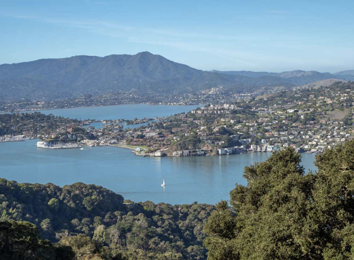
Where: Marin County, California
Length: 4.8 miles loop
Time: 2.5 hours
Difficulty: Easy
What to Expect: Located on Angel Island in the middle of San Francisco Bay, you must take a ferry ride out to Ayala Cove for this scenic hike. Follow the gentle switchbacks as you snake up Mount Livermore, the highest point on the island at 788 feet, and pick out San Francisco’s most famous landmarks, including Alcatraz, Telegraph Hill, and the Golden Gate Bridge from the top.
Pets Permitted: Dogs not allowed.
Mount Diablo Summit Trail

Where: Contra Costa County, California
Length: 7 miles out-and-back
Time: 4.5 hours
Difficulty: Hard
What to Expect: Hiking enthusiasts can ascend Mount Diablo, which looms over the East Bay at 3,848 feet, for a sprawling lookout over the Sierra Nevadas, the Farallon Islands, and even Yosemite. For a less intense workout, drive up to the visitor center just below the summit and enjoy an easy but rewarding stroll down Mary Bowerman Trail.
Pets Permitted: Dogs not allowed.
Tomales Point Trail
Where: Marin County, California
Length: 9.4 miles out-and-back
Time: 4 hours
Difficulty: Moderate
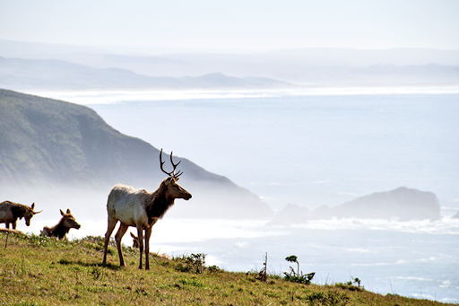
What to Expect: A Bay Area favorite, this stunning hike cuts through Point Reyes National Seashore—home to the Tule Elk Reserve—where you’ll find bugling elk in the summer and fall, as well as foxes, coyotes, and hawks. With the crashing ocean on one side and the bay on the other, it’s one of the best coastal trails in the state.
Pets Permitted: Dogs not allowed.
French, Bridle, and Stream Trail Loop

Where: Alameda County, California
Length: 8.1 miles loop
Time: 4 hours
Difficulty: Moderate
What to Expect: For the ultimate forest bathing, this serene hike takes you through Reinhardt Redwood Regional Park, the largest remaining natural stand of coastal redwood at 1,833 acres. Make a loop through the giant trees and forget that you’re just miles away from downtown Oakland.
Pets Permitted: Dogs are welcome, and may be off-leash in some areas.
Lands End Trail
Where: San Francisco County, California
Length: 3.4 miles loop
Time: 1.5 hours
Difficulty: Moderate
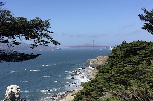
What to Expect: One of San Francisco’s most iconic hikes, this trail boasts cypress and eucalyptus groves, the historic Sutro Baths (the ruins of a 19th-century ocean-fed bathhouse), and some of the city’s best views of the Golden Gate Bridge. For an extra adventure, take a side trail down to the rocky beach.
Pets Permitted: Dogs are welcome, and may be off-leash in some areas.
Twin Peaks
Where: San Francisco County, California
Length: 2 miles out-and-back
Time: 1 hour
Difficulty: Easy
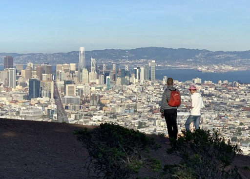
What to Expect: Enjoy a 360-degree view of San Francisco within city limits by climbing up 400 feet to the north peak overlook. The coastal scrub and grassland habitat provides a glimpse at what the city looked like before it was developed. If you’re lucky, you’ll catch a glimpse of the endangered mission blue butterfly.
Pets Permitted: Dogs are welcome, but must be on a leash.
More about San Francisco:
- Best Campgrounds Near San Francisco
- Best National and State Parks Near San Francisco

